
![]() We move on to review the design options being considered in the latest consultation on replacing the Headford Road (Kirwan) Roundabout with traffic lights. (Please see preceding article for a submission template). This discussion is based on the latest consultation document. The document sets out 6 design options for consideration. However three of the options involve building new slip roads (Options labelled 2a, 2b 2d). This means they can be dismissed out of hand as unsuitable for an urban area.
We move on to review the design options being considered in the latest consultation on replacing the Headford Road (Kirwan) Roundabout with traffic lights. (Please see preceding article for a submission template). This discussion is based on the latest consultation document. The document sets out 6 design options for consideration. However three of the options involve building new slip roads (Options labelled 2a, 2b 2d). This means they can be dismissed out of hand as unsuitable for an urban area.
This leaves three options that merit further consideration.
Option 1
- Kirwan Roundabout replaced with a 5 arm signalised junction.
Option 3A
- Kirwan Roundabout will be replaced with a 4-arm signalised junction.
- Coolagh Road will no longer be accessed from the Kirwan junction.
- Coolagh Road will be diverted southwards through the ‘Circus Field’ to form a 4-arm signalised junction with the N6 Headford Road and Dunnes Stores Entrance.
- Dunnes Stores Entrance will be moved northwards to facilitate a 4-arm signalised junction.
Option 3B
- Kirwan Roundabout will be replaced with a 4-arm signalised junction. Coolagh Road will no longer be accessed from the Kirwan junction.
- Coolagh Road will be diverted northwards to the front of the Menlo Park Hotel to form a 3-‐arm signalised junction on the N84 Headford Road.
- A left slip lane allowing traffic to access Coolagh Road from the N6 Headford Road is being considered as part of this option.
Discussion: Option 1 (5 arm traffic signals)
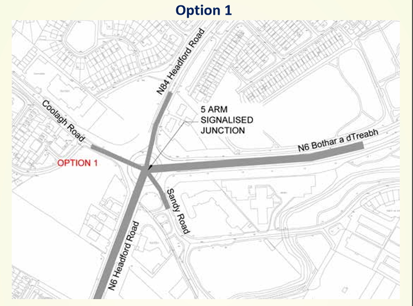
Screen grab of Option 1 from the consultation document
2. The County Council Yard at Liosbán (Orange boundary below)
3. The ESB land between Sean Mulvoy Road and Sandy Road (Green boundary below)
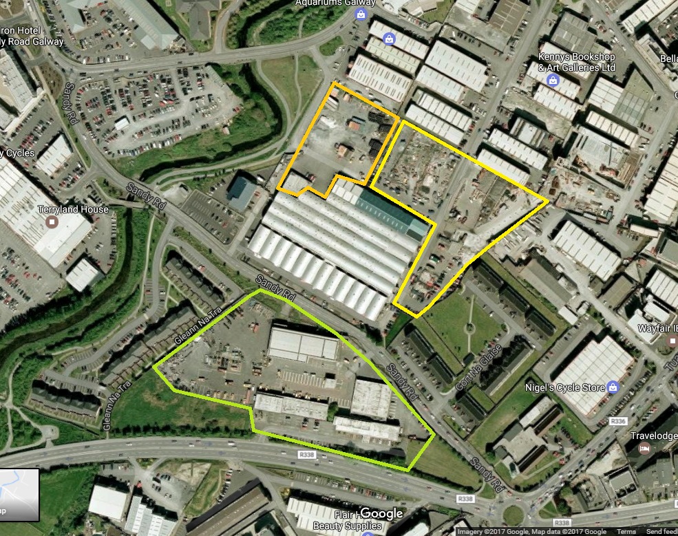
Google maps extract showing state/semi-state properties at Liosbán and Sean Mulvoy Rd
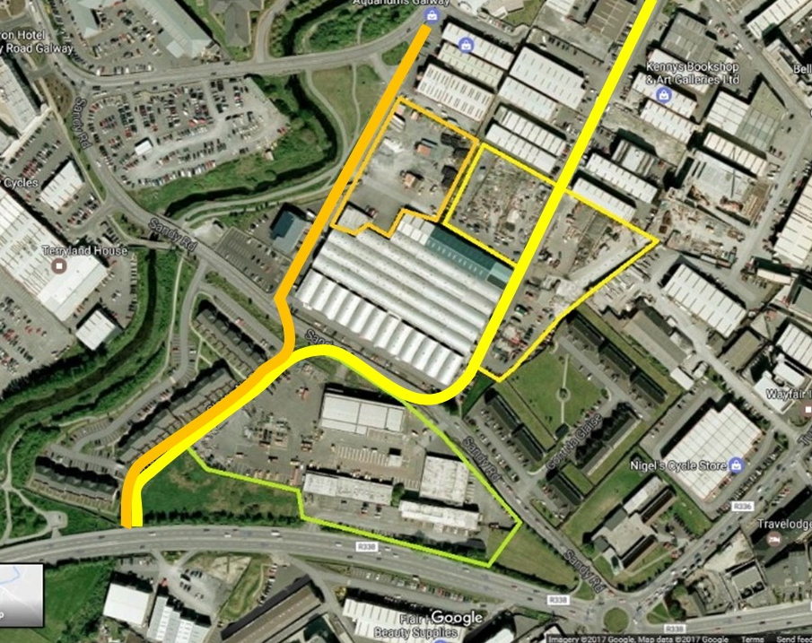
Google maps extract showing alternative access corridors using state/semi-state properties at Liosbán and Sean Mulvoy Rd
Discussion: Options 3A and 3B (Coolagh Road diversion)
Options 3A and 3B involve diverting the Coolagh Road to other locations. One north of the current junction and one south. One point of concern is the designers also appear to be threatening to use another slip road with option 3B which would defeat the underlying purpose of removing the roundabout.
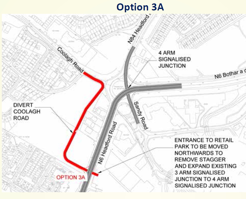
Screen grab of Option 3A from the current consultation document.
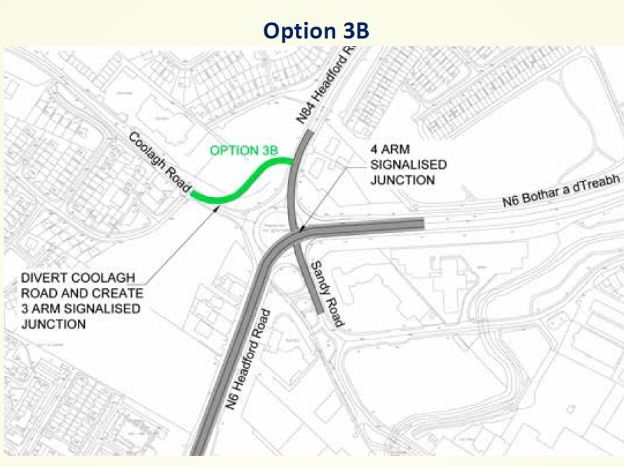
Screen grab of Option 3B from the current consultation document.
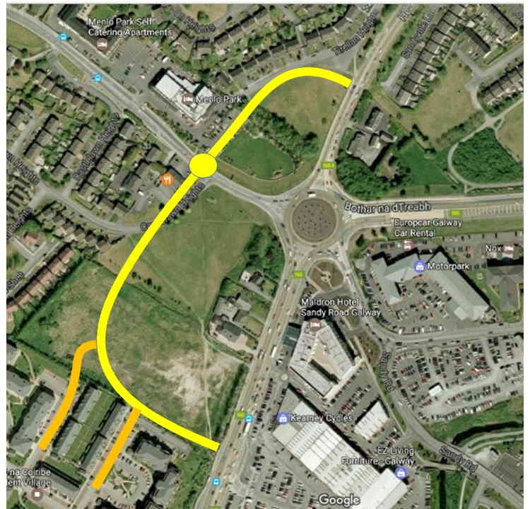
Google maps extract showing our proposal for a combined Option 3A and 3B.
Leave a Reply